Weather Stations Provide Farmers Timely Information
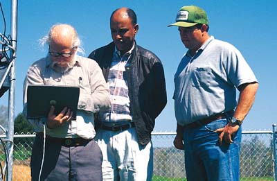
North Alabama farmers can soon make better decisions about planting, irrigation and pest management thanks to a network of soil profile and weather-monitoring stations being set up by Alabama A&M University.The network includes 23 stations located in Jackson, Madison, Marshall, Morgan and Limestone counties. Dr. Teferi Tsegaye, the lead researcher on the project, said Natural Resources Conservation Service employees helped identify the sites based on soil type and location. Each soil profile station measures soil moisture, temperature, rainfall and the movement of heat through the first few centimeters of topsoil. In addition, seven locations include weather stations that measure air temperature, humidity and solar radiation as well as wind speed and direction. Those seven stations collect data every 15 minutes and transmit hourly reports to Alabama A&M via radio towers. The data is then made available on the Internet at www.wcc.nrcs.usda.gov as part of USDA’s Soil Climate Analysis Network (SCAN).One of the weather stations is located on David Hodges’ poultry farm near the Five Points community in Marshall County. He said having accurate, up-to-date weather information is as important to livestock and poultry producers as it is to row crop farmers.”We’re under the gun with the new CAFO (Concentrated Animal Feeding Operations) regulations. You’re not supposed to spread litter on saturated soils or before heavy rainfall events,” Hodges said. “But the weather office is in Huntsville, and they might get rain, and it will be sunshiny here. With a weather station here, I’m covered from a liability standpoint. This gives me data for Five Points, not Huntsville.”Tsegaye worked with government officials for four years to make the network a reality. NASA originally funded the project to validate soil moisture data being collected by satellites. Tsegaye said that goal could have been accomplished using hand-held probes and global positioning technology, but he saw the NASA project as a chance to establish permanent soil profile stations.”We must have continuous, long-term data to be able to make accurate forecasts,” Tsegaye said. “These stations will benefit not just farmers, but everyone. If the soil is saturated and a heavy rain is coming, we will know that area is going to flood.”Tsegaye said the weather data also will enhance a water quality study he’s conducting in the Wheeler Lake Basin. By comparing data from the two projects, researchers can better understand how rainfall, soil type and land use affect water quality.NASA’s initial investment of $100,000 was later matched by USDA and Alabama A&M University. Eventually, Tsegaye would like to expand the project statewide, if additional funding becomes available.Currently, the project covers 6,300 square kilometers (about 2,500 square miles). Robert Metzl, a physicist working with Tsegaye, said the 23 sites provide enough data to give researchers a good idea of the weather conditions throughout the project area. “We take all the data and integrate it into a (computerized) model,” Metzl said. “We then are able to interpolate between stations.”Metzl said soil moisture data from the SCAN sites will help farmers know when to irrigate and apply chemicals. Soil temperature information will help them know when to plant. Perhaps more importantly, the weather stations will provide scientific data farmers can use to ensure their management practices are environmentally sound, Hodges said.”As farmers, we don’t want to pollute. If I’m doing something that’s causing a problem, I want to know so I can fix it,” he said. “But if I’m not causing a problem, I don’t want to be blamed for it.”Hodges said information from the weather stations could be used to identify environmental problems on farms or to disprove allegations that farmers are polluting the water and air. The stations also will provide baseline data for different soil types so future environmental regulations won’t have to be written with a “one-size-fits-all” mentality, he added.”This is just another thing I can use to manage my operation better,” Hodges said.